CE Capstone - Projects
2020-2021

Pterra
Members

Peter Feghali

Cher Lin

Jackie Burd

Swetha Pillai

Tiffany Cowan
Description
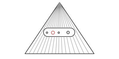
The current state of the art UAV obstacle avoidance requires an array of expensive time-of-flight sensors, LiDAR, or ultrasonic sensors. The new 60GHz RADAR allows for the same functionality but at a drastically lower cost. These RADAR chipsets are around $20 per sensor, and with a more than 100x improvement in measurable volume compared to time-of-flight sensors. These sensors are also solid-state and are smaller than your thumbnail. This capstone project aims to implement obstacle avoidance in drones with 60GHz RADAR and possibly demonstrate 3D autonomous mapping with this technology. This RADAR based system could be used for navigating dangerous areas full of smoke where individuals could not traverse, conduct safe travel in warehouses, or simply act as a safety measure for consumer drones.
Resources
Sponsors

Parkingbase
Members

Andrew Lu

Finn Linderman

Jun Cho

Luyao Han
Description
The Smart Parking Lot project's goal is to create small, inexpensive wireless devices that can be placed on individual parking spots within a large parking structure, each capable of lasting five years on a single charge. Each device contains a vehicle-detecting sensor that can detect whether a car is parked in its spot. The devices are all connected using a low-power communication protocol to a central gateway device. This gateway device propagates sensor data to the Internet, allowing users to view parking spot availability and be guided to an open spot through a mobile application or website.
Resources
Sponsors
Trac
Members

Corbin Jee

Albert Tran
Brycen Westgarth

David Mleczko

Lucas Relic
Description
TRAC will enable first responders to diagnose patients with trauma-induced coagulopathy rapidly. Currently, coagulopathy tests can only be administered using large, stationary machines over the course of half an hour. Our device will give similar or identical results within a few minutes while remaining portable. TRAC achieves this by performing a temperature-controlled analysis on a sample of blood over 2 minutes. TRAC is designed to be a hand-held, pocket-sized device.
Resources
Sponsors

Project Argus
Members

Naimul Hoque

Abel Semma

Edwin Varela
Oles Bober

Rishit Arora
Description
NASA astronauts perform maintenance and assembly procedures, which contain many complicated steps that are difficult to follow. As a result, astronauts are required to contact ground control for guidance. This poses a significant issue for future space exploration missions that require traveling to farther locations. For example, as astronauts prepare to head towards Mars, communication delay with ground control could take up to 20 minutes. With the help of NASA’s Ames Research Center, Project Argus utilizes Machine Learning and Computer Vision concepts to develop a system that can track and validate each step of a procedure performed by an astronaut. The system will communicate with various cameras both located throughout the workstation and on the individual to perform object detection and template matching.
Resources
Sponsors

Anchorless
Members

Benigno Ortega

Corey Zhou

Ryan Levy
Tahereh Mehrjerdy

Winston Lee
Description
The Spotter buoy is a data collection device. An anchorage system is used to prevent the buoy from drifting away from its designated location. Because the anchor must be manually deployed, adjusting the position of the buoy is a time consuming task. Our team has two main objectives. The first objective is to design a vehicle to replace the anchorage system that will autonomously reposition the Spotter buoy within a designated zone. Secondly, the system will receive new coordinates via cellular link and navigate to the corresponding location. By completing these goals, our team hopes to allow UCSB’s Coast Lab to reposition, deploy and retrieve the buoy without needing to set foot into the ocean.
Resources
Sponsors

BlueFinder
Members
Stefan Crigler

Arthur Lobins
Cynthia Alvarez

Renny Hong

Robert Tremewan
Description
BlueFinder addresses the problem of finding the location of Bluetooth devices in a small area. Using only information from the physical signals emitted from nearby Bluetooth devices, the system will dynamically estimate the devices' location and display the information to the user. The signals will be collected by the XTRX software-defined radio, and the processing will be done on an Nvidia Jetson Xavier SOC. All components will be connected using a PCB. Estimates provided by the angle of arrival and time difference of arrival methods will be combined into a single estimated location. The information will be associated with the device and logged, allowing the user to scroll through the devices' location history.
Resources
Sponsors
CAT
Members

Jack Tang

Joe Yu

Kerr Ding

Ming Wen

Zhanglu Wang
Description
In this project, we use a depth detection camera to prevent a robotic arm holding a microscope from colliding with objects in the operation theatre. Our system recognizes the robot's hand from the blocking object and ensures the arm's path is collision-free. To achieve this function, we also move/rotate our depth detection camera with a step motor to trace the robotic arm's movement.
Resources
Sponsors
Seashield
Members
Chris Scott
Andrew Berry

Andrew Cizas

Derek Cheng

Eric Kim
Description
Saltwater is an electrolyte that speeds up the process of rust and corrosion. SeaShield is an automated drone system designed to slow the corrosion process by autonomously applying a corrosion inhibiting liquid to problem areas on a naval vessel. The drone carries a liquid payload to a problem area, applies the liquid in a methodical, overlapping spray pattern for maximal coverage, and returns to its home station. The process is fully automated, but can be observed from an Android application and manually overridden if necessary. The SeaShield system utilizes image sensors and computer vision to identify corrosion and a positioning system to log rust location and chart flight paths.